Redesigning Farm Decisions: Kenzugi on Regenerative Agriculture and Land Restoration in Africa
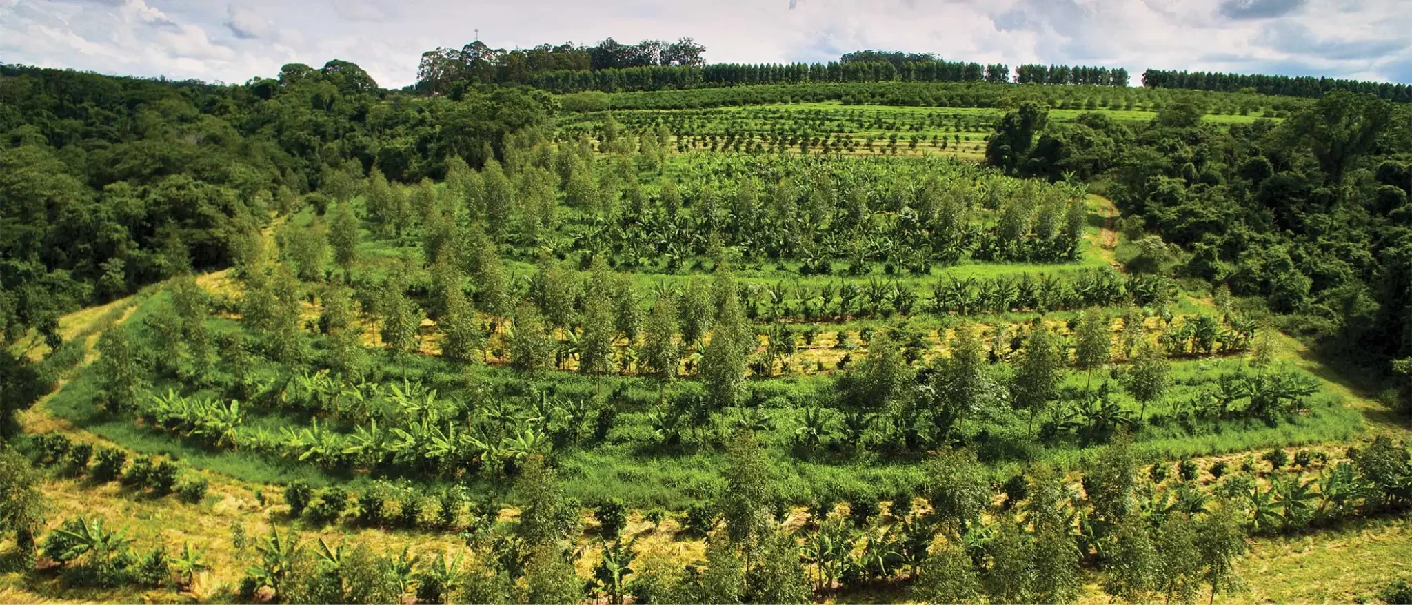
Image Credits: CGIAR Image Library
Agriculture generates roughly 35% of global greenhouse gas emissions. Climate change, in turn, degrades the soils, water systems, and ecosystems that food production depends on. In Africa, this feedback loop is accelerating faster than anywhere else. Rising temperatures, erratic rainfall, and already degraded land are shrinking the margin for error each season.
The Kenzugi team argues that the real problem isn't effort or intent. It's when decisions get made. In farming, the most consequential choices happen early: what to plant, where to place water, how many animals the land can carry. Once those decisions are taken, biology takes over, capital is committed, and climate shocks compound the consequences. By the time problems show up in yields or livelihoods, it's usually too late to change course.
Regenerative agriculture promises a way out, but too often it arrives as a list of practices rather than a redesign of the decision environment itself. Kenzugi built the KOOL Tool to shift that. In this ‘Member Spotlight: Ask the Nature Tech Expert’ interview, the team explains their hierarchy of priorities (water first, carbon last), how they combine satellite data with farmer knowledge and bee pollen profiles, what their 200-hectare pilot in Kenya is teaching them, and why meaningful scalability means the same design logic needs to work across one acre and 50,000 hectares.


Team Kenzugi: Karene Melloul, Cecilia Mulu, Cameron Goodman, Mwangi Wamae, Laura Mugeha, Joshua Kibuye
Origin and Vision
Q. What inspired Kenzugi to build a farm design tool, and what gap are you hoping it fills in regenerative agriculture?
Kenzugi started from a simple, uncomfortable reality: food and climate are now locked in a circular trap. Agriculture generates roughly 35% of GHG emissions, while climate change simultaneously degrades the soils, water systems, and ecosystems on which food production depends. In Africa, this feedback loop is accelerating faster than anywhere else, with rising temperatures, erratic rainfall, droughts, and already degraded land shrinking the margin for error each season.
What makes this trap so hard to escape is not a lack of effort, but the way decisions are made under pressure. In agriculture, the most consequential choices happen early: what to plant, where to place water, how many animals the land can carry. Once those decisions are taken, biology takes over. Capital is committed, risk is locked in, and climate shocks compound the consequences. By the time problems show up in yields or livelihoods, it is usually too late to change course.
Regenerative agriculture promises a way out of this loop, but too often it is introduced as a list of practices rather than a redesign of the decision environment itself. Farmers and projects are asked to adopt better methods without being given the tools to properly assess soils, water flows, climate exposure, crop interactions, and market risk before acting. In high-income farming systems, this uncertainty is buffered by data, insurance, and advisory infrastructure. In most African contexts, it is not.
That gap is what inspired Kenzugi to build a farm design tool. The KOOL Tool exists to shift regenerative agriculture upstream, to the moment where risk is first assumed. It brings together landscape diagnostics, hydrology, ecology, and economics to design farms that are resilient to climate volatility, not dependent on perfect execution. In a decade where every season matters, escaping the climate–food trap requires better decisions before the first seed goes into the ground.
The Kenzugi Optimal Omnisystem Learning (KOOL) Tool offers a practical solution to the crisis for African farmers of all sizes. It enables access to the blueprint for a regenerative system, taking regenerative knowledge out of only expert hands and into on-farm practice.
The gap this tool fills is giving farmers who have seen their entire cow herd die, their crops fail despite all their best efforts, and their costs continue to rise with little increase in income, a realistic pathway forward with a farm plan in place. We are making this knowledge accessible, reducing the barriers to costly expert guidance, and proving it can be done at scale. This way, we can slowly shift the momentum of large-scale producers towards sustainable approaches, because landowners across the continent are reducing their financial risk profile, achieving yields more predictably, and seeing their outgoings drop drastically.
Approach and Method
Q. What principles shape your approach to soil health, water flow and long-term land productivity?
Our approach to soil health, water flow, and long-term land productivity is shaped by a clear hierarchy of priorities rooted in Regrarians thinking and field experience in climate-exposed landscapes.
Water comes first. Water is the master variable in any landscape. If it moves too fast or concentrates in the wrong places, soils erode, nutrients are lost, and biological systems break down. We therefore begin by understanding how water enters, moves through, and leaves the land, and by designing to slow, spread, and sink it across the whole system. Without this foundation, everything else is fragile.
Soil health follows water. Once moisture is retained in the landscape, soil biology can function. We treat soil as a living system rather than a chemical medium, focusing on organic matter, root systems, microbial life, and minimal disturbance. Ground cover, diversity, and continuous biological activity are the practical conditions that allow soils to regenerate and remain productive under stress.
Biodiversity is the stabilising layer. Functional diversity in plants, trees, animals, and microorganisms is what keeps soils and water systems working over time. Biodiversity regulates pests, deepens rooting profiles, improves nutrient cycling, and buffers climatic variability. It is not an aesthetic choice; it is a core performance factor.
Carbon is a consequence of the first three elements. When water is managed well, soils are biologically active, and biodiversity is restored, carbon accumulates naturally in soils and biomass. In this framework, carbon is not farmed directly. It is a lagging indicator that confirms the system is functioning as intended.
Only then does production come into focus. Yields and income matter, but they are outcomes of good design, not starting points. By prioritising water, soil, biodiversity, and carbon in that order, we build productive systems that remain resilient, profitable, and regenerative over the long term.
Q. You combine field knowledge with remote sensing. How do these data sources come together in practice?
We combine field knowledge with remote sensing because neither is sufficient on its own. Satellites can see patterns at scale, but they cannot fully explain why those patterns exist. Farmers and field teams understand context, history, and constraints, but they cannot easily see hydrology, vegetation change, or degradation trends across whole landscapes. The value comes from bringing these perspectives together into a single decision process.
In practice, we start with remote sensing to establish a shared baseline. Through our partnership with the Landbanking Group, we use satellite imagery and spatial analysis to map soil condition, vegetation cover, biomass, hydrological flows, erosion risk, and habitat connectivity. This allows us to build a spatially explicit picture of the landscape and translate it into a working digital twin of the farm before any major decisions are taken.
Field data then grounds and sharpens that digital twin. Soil sampling, infiltration tests, biodiversity observations, grazing assessments, and farmer knowledge help explain what satellites suggest and correct what they miss. Our scientific partnerships with CIFOR-ICRAF, ILRI, and CIAT ensure that the indicators feeding the model are biologically meaningful and decision-relevant, not just visually convincing.
Biodiversity adds another layer of intelligence. Through our collaboration with BeeOdiversity, we sometimes joke that we employ millions of enumerators. Bees forage freely across the landscape, sampling what is actually flowering, connected, or under stress. Their pollen profiles and colony health feed back into the digital twin as living signals of ecosystem function — something no satellite can fully replicate.
The integration happens when all these signals inform decisions together. Remote sensing sets the structure, field data adds depth, biodiversity shows response, and the digital twin allows us to test, adjust, and learn before risk is locked in. This continuous loop reduces uncertainty upfront and keeps regenerative design grounded in how landscapes actually behave over time.
Data, Technology and Methodology
Q. You are combining ground-level knowledge, farmer insights and remote sensing. How do you bring these data sources together and make them useful in practice?
The challenge in regenerative agriculture isn't the lack of data; it's that the right data rarely reaches farmers at the right moment to actually change decisions. Satellites capture vegetation health. Research institutions publish soil maps. Farmers know their microclimates intimately. But these knowledge streams rarely converge into a single, usable picture before critical choices get made.
Effective regenerative design requires multiple data types working together: digital elevation models showing where water flows, satellite imagery revealing patterns of degradation over time, soil surveys providing baseline soil health data, and climate projections helping to anticipate drought stress and shifting seasons.
But field observations validate and ground-truth what satellites suggest. Infiltration tests show whether water will actually sink where models predict.
Farmer knowledge provides the operational logic. Cropping calendars, labor availability, market access, and management capacity aren't supplementary; they are structural constraints any viable plan must accommodate.
The problem is that these data streams live in different systems, use incompatible formats, and require specialized expertise to interpret. A farmer designing a regenerative system currently needs to download elevation data from one portal, hire a hydrologist to model water flows, engage an agroforestry specialist for tree recommendations, find separate platforms for carbon accounting and economic modeling. At each step, data gets manually transferred and siloed. Holistic design becomes nearly impossible.
The KOOL Tool we're developing works backward from the decision point. Instead of asking "what data exists?" We start with "what decisions determine whether a regenerative farm succeeds?" and assemble only data that materially affects those outcomes.
This is shaped by the Regrarians' 10-layer framework, which sequences planning from least to most flexible: climate and geography first, then water (highest-leverage intervention), access, forestry, infrastructure, soils, economy, and energy. By encoding this logic, water flow analysis happens before crop placement, access routes before fencing, and economic viability alongside ecology.
What we've learned on our demo farm is that value comes not from more data, but from data that converges at the design stage. When hydrology, soil health, biodiversity, and economics are considered together before implementation, regenerative systems become less risky. Farmers see consequences before committing capital. Advisors test scenarios without needing expertise in every discipline.
Q. After exploring existing tools and methods, what gaps or opportunities did you identify that shaped your approach?
First, severe fragmentation: landowners and consultants juggle multiple disconnected platforms for mapping, planning, monitoring, and verification, each with its own data silos and workflows. Someone designing a regenerative farm might use one tool for hydrology analysis, another for carbon modeling, a third for biodiversity planning, and yet another for verification and reporting. This fragmentation is not just inefficient; it makes holistic design nearly impossible because these systems don't talk to each other.
Second, we found a lack of truly integrated, systems-based design tools. Effective regenerative farm design requires understanding how water, soil, biodiversity, and land use decisions interact and influence each other, you can't optimize crop placement without understanding water flows, or design grazing systems without considering soil health and habitat connectivity. Existing tools tend to address single issues in isolation rather than treating the farm as an interconnected ecosystem.
These gaps revealed a clear opportunity to create a unified platform that integrates the entire workflow from initial assessment through design, implementation planning, and ongoing monitoring, while encoding proven regenerative frameworks like the Regrarians® 10-layer methodology.
Working with Farmers and Local Knowledge
Q. Farming is deeply cultural. How are you making sure the tool respects local knowledge and reflects how different regions farm?
Our first pilot reflected this approach. We began with a demonstration plot and direct engagement with around 100 smallholder farmers, working with the Green Belt Movement. The focus was on learning how farmers read their land, manage risk, and make decisions, rather than extracting data or pushing practices.
We engage through cooperatives, Community Forest Associations, and other trusted civil society organisations, because this is where knowledge circulates and legitimacy is built. These structures help ensure that local logic, constraints, and priorities shape the tool from the start.
In practice, local cropping systems, grazing patterns, and seasonal calendars are inputs into the digital twin, not outputs. When the tool conflicts with lived experience, it is the model that adapts, not the farmers.
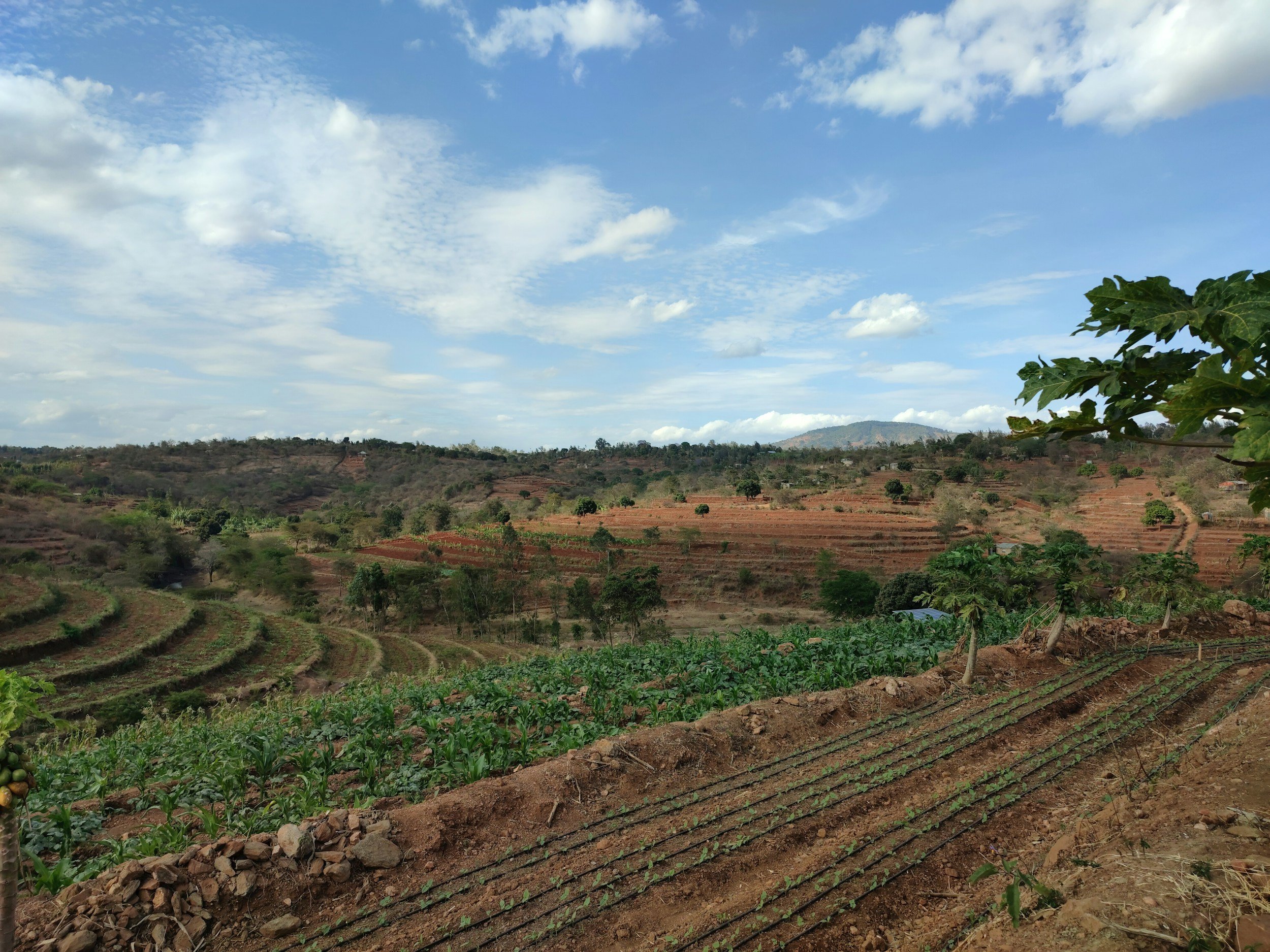
Image Credit: Unsplash
Q. How are you tackling the challenge of farmers wanting to “see to believe” before adopting new tools?
Seeing is believing is not a resistance to change; it is a rational response to risk. Farmers adopt new tools when uncertainty is reduced in ways they can trust, not when information improves in the abstract.
That is why we anchored the KOOL Tool in physical demonstration first. Our 200-hectare model farm in Nyeri County functions as a full-scale, working proof point where farmers can see regenerative systems performing across seasons, soils, and market conditions. It shows that the model works not just in theory, but at real operational scale.
At the same time, scale can be intimidating, so we pair this with one-acre demonstration plots on the farm. These mirror the size, labour realities, and risk exposure of smallholders, allowing farmers to relate what they see directly to their own land. It shortens the mental leap from “their system” to “my field.”
We also deliberately bring farmers together with peers and practitioners from across the country who are already doing this successfully. Adoption accelerates when farmers learn from other farmers, not from instructions. These exchanges normalise change and make success feel attainable rather than exceptional.
The digital twin then closes the loop. The KOOL Tool does not just provide information; it shows consequences. Farmers can see what happens if they change planting density, grazing timing, or water management before taking the risk in real life. By combining physical proof with simulation, we reduce uncertainty upfront and turn “seeing is believing” into a safe pathway for action, not a leap of faith.
Piloting and Scaling
Q. Why start with a pilot site in Kenya, and what do you hope to learn from it?
We started with a pilot site in Kenya because this regenerative hub acts as a high-impact landscape where we can put into action the practical solutions we are testing.
The pilot sits at the intersection of urgency and capability. Climate volatility, land degradation, and rising input costs are already reshaping agriculture, but Kenya also has the conditions needed to test and adapt solutions quickly. Adult literacy is around 83%, and digital access is high by regional standards, with widespread mobile connectivity and growing internet use. This makes it easier to engage farmers, workers, and communities with data-driven tools and learning processes that enable the regenerative agriculture revolution to grow.
Kenya is also the place to be operationally. It has a strong entrepreneurial culture and long-standing access to international markets through exports such as tea, coffee, cut flowers, and fresh produce. These value chains have created a mature transformation and processing sector, along with familiarity with quality standards, traceability, and logistics. That matters because the regenerative agriculture pilot only scales if it connects to real markets, not just good intentions.
From a land restoration perspective, Kenya combines rapid degradation with exceptional restoration potential. Significant areas are losing soil, water retention, and productivity, yet many targeted landscapes still have intact ecological foundations. With the right hydrological design, soil regeneration, and biodiversity recovery, these areas can rebound quickly and at scale.
Through the pilot, we can learn more about all these interactions to inform the KOOL Tool and ensure that regenerative design works for Kenyan farmers.
Q. What does meaningful scalability look like for this tool?
At the smallholder level, scalability means supporting thousands of farmers to make lower-risk, better-informed choices without asking each one to become a technical expert. By embedding local data, demonstration learnings, and simple simulations, the tool helps smallholders see what changes make sense on one or two acres, under their specific soils, water constraints, and market realities.
At the other end of the spectrum, scalability means something very different. Kenya has large landowners sitting on 10,000, 20,000, sometimes 50,000 hectares of poorly managed or degraded land. For these actors, the challenge is not adoption but redesign at scale. The KOOL Tool allows whole landscapes to be read, zoned, and phased, helping landowners understand where restoration should happen first, where production can be intensified, and how water, biodiversity, and infrastructure need to be coordinated across tens of thousands of hectares.
What connects these two ends is a shared design logic. The same principles apply whether the unit is one acre or 50,000 hectares: water first, soil and biodiversity next, production last. The tool allows that logic to travel across scale, while the implementation adapts locally.
Meaningful scalability, in this sense, is not replication for its own sake. It is the ability to move from pilots to landscapes, from individual farms to coordinated systems, removing barriers to meaningful food system transformation.
Collaboration and the Nature Tech Ecosystem
Q. What drew you to the Nature Tech Collective, and how do you see your work adding value to the community?
What drew us to the Nature Tech Collective is a shared belief that this challenge is too big, too complex, and too urgent to address in isolation. Climate, food systems, and land degradation require collaboration rather than competition, and real progress depends on building solutions together that can work across very different landscapes and contexts.
We are strong believers in community. Instead of reinventing the wheel, we want to build alongside others in the nature-positive ecosystem, combining strengths and learning from each other. Many organisations already generate valuable data and insights; the opportunity lies in connecting these efforts so they reinforce rather than duplicate one another.
Our contribution to the Collective is a practical one. Through our work, we focus on helping turn existing data into coherent design choices on the ground, and on creating the conditions for shared learning between practitioners, technologists, and land stewards. What we seek from the Nature Tech Collective is exactly this: strategic collaboration, trusted connections, and a space where collective intelligence moves faster than any single organisation could on its own.
Q. What makes the Nature Tech Collective a meaningful partner for your work, and what kind of support or collaboration are you hoping to gain from the community?
The Nature Tech Collective is a meaningful partner because the KOOL tool depends on collaboration to function. We're designing a convergence layer where we are bringing together satellite data, biodiversity intelligence, field knowledge, and financial frameworks to shape better land decisions. But we can't build that ecosystem alone.
The Collective gives us access to the full range of expertise this work requires such as organizations working on remote sensing, biodiversity monitoring, MRV systems, finance, and digital infrastructure. We are aware that for meaningful impact, we need to move beyond siloed solutions, and the Collective creates the space where complementary tools and ideas can connect into real systems.
What we're hoping to gain is collaboration that accelerates real-world impact. That means finding and reusing relevant data that is already being generated across the network, finding pilot partners who can test KOOL in the field and refine it through practice, landowners and buyers of natural capital outcomes who can anchor demand and validate the model, and shared learning on standards and interoperability so tools built by different groups can work together. More than visibility, we value the Collective as a bridge that connects us to being part of the solution and allowing us to contribute to something larger than what we could build alone.
Personal Reflections
Q. What sparked your own interest in climate, land stewardship or regenerative farming?
My interest in climate, land stewardship, and regenerative farming grew out of nearly twenty years working in fragile and conflict-affected contexts. In countries at war or emerging from crisis, you develop a very sharp understanding of risk: how quickly systems break, how little margin there is for error, and how tightly food, stability, and livelihoods are intertwined. Land degradation and climate stress were never abstract issues there; they showed up directly in conflict dynamics, displacement, and long-term insecurity.
That experience made the urgency around nature impossible to ignore. When soils fail or water disappears, everything else follows. At the same time, it showed me what people are capable of when the stakes are clear. During COVID, in Kenya, we brought together engineers, manufacturers, health professionals, and local entrepreneurs and built locally produced devices in just three months. It was a powerful reminder that when urgency is shared, collaboration can move faster than anyone expects.
Food and climate now demand that same level of focus. They are no longer parallel challenges; they are inseparable, and they will define the next twenty years. How we grow food will determine whether landscapes regenerate or collapse, whether communities become more resilient or more fragile, whether climate pressure accelerates or eases.
That is why regenerative farming matters so deeply to me. It is one of the few places where action still scales hope. By restoring land, we restore options — for farmers, for ecosystems, and for future generations. There are many important problems in the world, but right now, there is nothing more fundamental than repairing the relationship between food, land, and climate. Getting that right changes everything.
Q. Any book, podcast or thinker you’d recommend to others exploring nature tech or agriculture?
We have loved learning from Darren Doherty and the Regrarians platform.
The Regrarians’ philosophy laid out in the Regrarians Handbook has shaped the way we plan and design natural systems. Their knowledge base for landscape design is exceptionally clear, grounded, and practical, and they are a big inspiration for Kenzugi’s model.
We also deeply value the Investing in Regenerative Agriculture podcast, hosted by Koen van Seijen. It has become the primary platform for building the conversation around what is actually working in regenerative agriculture, who is doing the work, and where meaningful engagement should happen.
Kenzugi's advice to others working in regenerative agriculture: value comes not from more data, but from data that converges at the design stage. When hydrology, soil health, biodiversity, and economics are considered together before implementation, regenerative systems become less risky. The team is looking for pilot partners to test the KOOL Tool in the field, landowners and buyers of natural capital outcomes to anchor demand, and collaborators working on remote sensing, biodiversity monitoring, MRV systems, and digital infrastructure. They're also seeking shared learning on standards and interoperability so tools built by different groups can work together. Learn more about Kenzugi's work here or connect with the team on LinkedIn.