
Code, Land, and Sovereignty: ProgramEarth's Case for Putting Communities First in Nature Tech
For this edition of Member Spotlight: Ask the Nature Tech Experts, we spoke with Manisha Priyadarshini, Interim Executive Director at ProgramEarth. ProgramEarth is a collective of Indigenous technologists that uses hackathons to connect conservation needs with technical capacity and open-source tools. The organization has connected 2.6 million acres to restoration work so far, including projects near the Rio Negro, in West Bengal, and in the Klamath River region, with a target of 30 million acres by 2030.
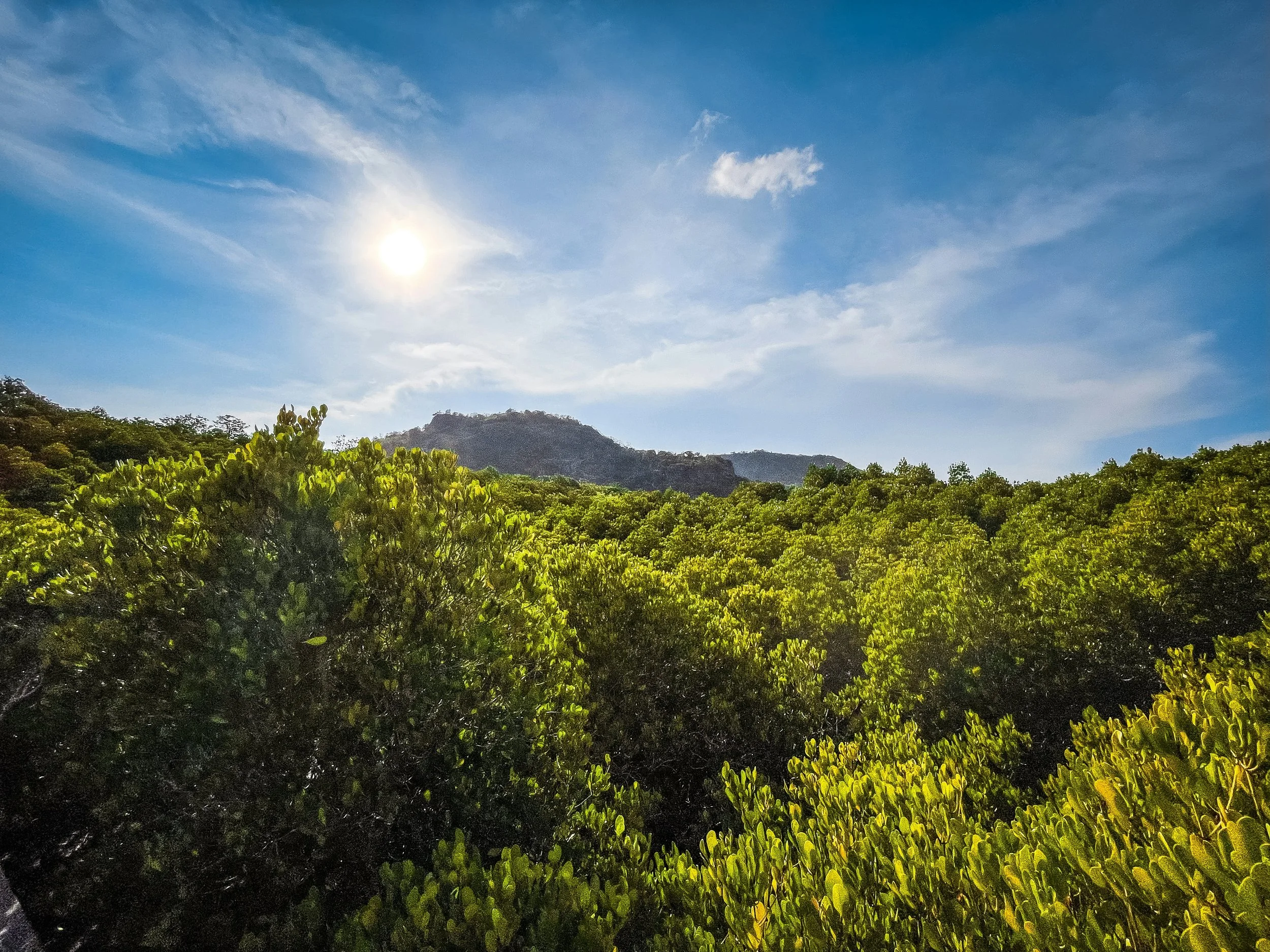
Photo by Nopparuj Lamaikul on Unsplash
About ProgramEarth
Q. ProgramEarth is a collective of Indigenous technologists. Can you tell us how it started and what problem you set out to solve?
We built ProgramEarth to close the gap between the communities already leading conservation work and the technical capacity, funding, and data infrastructure needed to strengthen that work. At the same time, thousands of technologists want to contribute to climate work.
As Indigenous technologists, we think about sovereignty and accessibility in a way that is grounded in the communities we are building with. We wanted to share the workflows, protocols, and understanding that make community-led technology possible.
Hackathons became one of our most effective tools because they turn a broad desire to “help the planet” into a focused, hands-on contribution: a flood-and-drought alert map, a soil-monitoring workflow, an environmental data pipeline, or a model that helps determine where locally produced biochar can restore degraded land.
They bring Indigenous communities, conservation practitioners, students, open-source maintainers, and technology companies into the same room. They help people understand that this work takes a village and that everyone has a role, from defining the problem and contributing ecological knowledge to building the technology and maintaining it over time.
Q. You're now 2.6 million acres deep and working toward 17 million. What does that scale actually mean on the ground?
The acreage matters, but it is not just a number on a map. On the ground, scale means different things in different bioregions: restoring drought-damaged firebreak ecosystems with Cipia partners near the Rio Negro; supporting Santali-led soil restoration with biochar and mycelium in West Bengal; reconnecting salmon recovery, water quality, and watershed health in the Klamath River region; and strengthening water security across farms, Tribal lands, coastal systems, and watersheds.
We currently have 2.6 million acres connected to restoration. The next phase is to launch several watershed pilots across 17 million additional acres, within a broader goal of building the infrastructure needed to support 30 million acres by 2030.
For us, scaling does not mean copying and pasting one technology across millions of acres. It means creating shared, open infrastructure: sensors, data models, APIs, monitoring practices, and workforce pathways that can be adapted locally. The unit of scale is not only the acre. It is the number of communities with the capacity to measure change, govern their data, attract funding, and continue the work on their own terms.
Q. You came from seven years as a solutions architect at GitHub. What did that experience teach you, and how did it shape the way you think about open source for conservation?
GitHub taught me that open source is fundamentally about community architecture: onboarding, documentation, mentorship, remote collaboration, and creating a project that can continue after its original builders step away. At ProgramEarth, we have expanded the idea of a maintainer beyond computer scientists to include students, community members, Indigenous land stewards, and GIS practitioners. Our challenge is to help people learn open-source practices, full-stack development, and geospatial tools within the context of a real ecological need—and give each person a meaningful way to carry the work forward.

Photo by Nicolas Arnold on Unsplash
The Work
Q. You use hackathons to translate conservation needs into open-source tools and data. How does that process actually work, and what has surprised you about what comes out of it?
We spend significant time defining the user and bringing their context into the room through Tribal leaders, scientists, and land stewards. Because participants arrive with different skill levels and only a limited amount of time, we create a choose-your-own-adventure: tightly scoped tasks for people who want a clear entry point and an ideation track for those ready to explore. Sponsors help define the challenge, students build, and agencies retain the open-source code, models, and workflows.
The Manaus hackathon produced a map for flood and drought alerts. Another Code for the Planet event produced an AI model that brings soil, vegetation, and Indigenous knowledge together to identify where locally made biochar could be most effective. What surprises me is how quickly people change when the problem is real. A student may arrive thinking they are practicing GIS or AI and leave understanding that they helped build a piece of environmental infrastructure. The hackathon is not the finish line. It is a bridge from curiosity to contribution, and often from education to a career in nature tech.
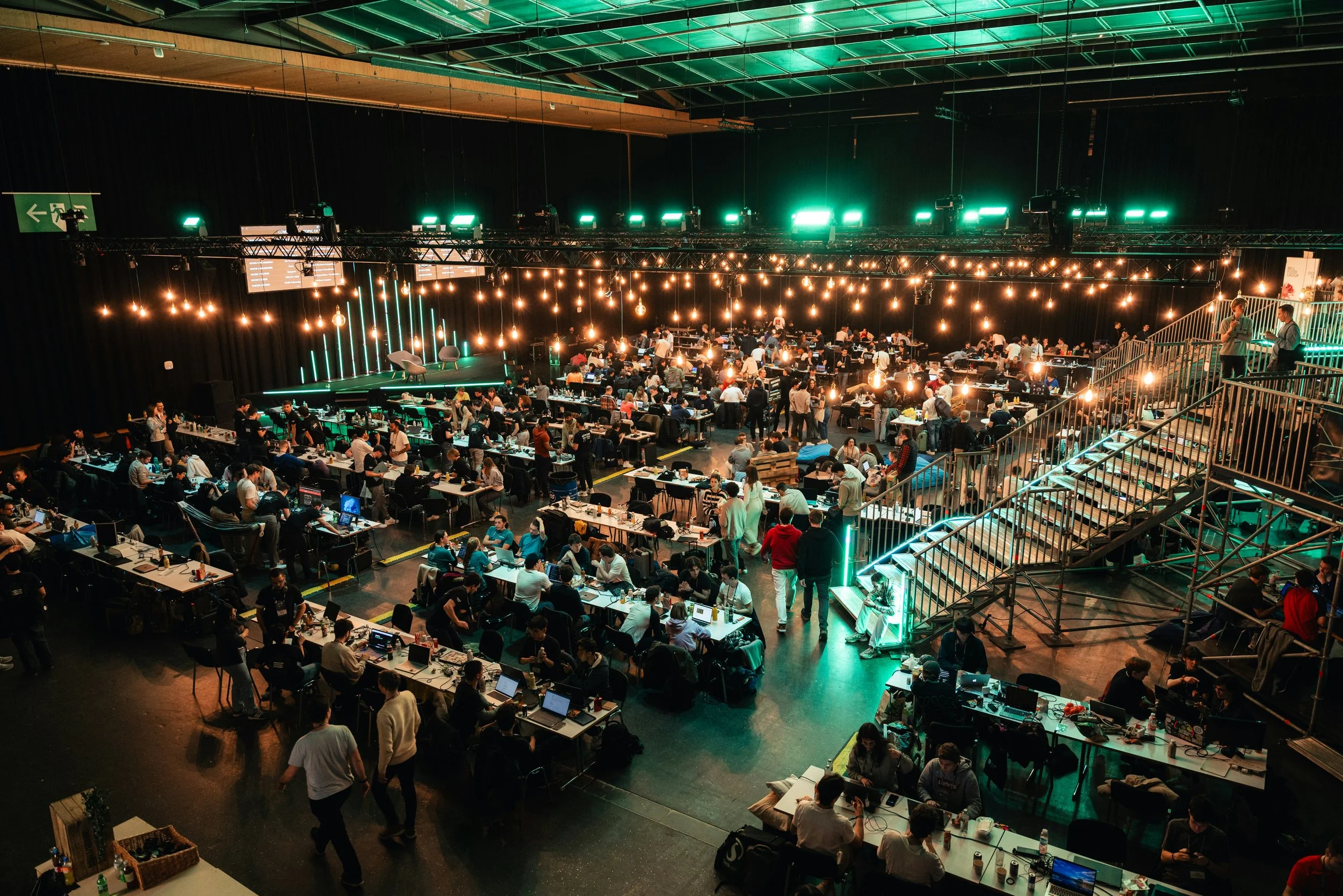
Photo by Mirea Mazzei on Unsplash
Q. You're working with Tribal Nations on bioremediation data modeling, but the nations want ownership of those models. How do you navigate data sovereignty in practice, especially when companies and funders want access?
Sovereignty means being able to decide when access is appropriate and what respectful, reciprocal access requires. We follow each community’s governance protocols. For example if a Tribal Nation’s governance is treaty based, that may include authorization through a Tribal resolution. We developed TerraMark so communities can choose which ecological datasets institutions may access, define acceptable uses, and set compensation for each API query. In Utah, community knowledge supported agricultural and watershed planning while collective grants circulated resources back through the partnership. Institutions gained better information, but the communities retained authority and a way to sustain the work.
Q. Traditional ecological knowledge often gets talked about as a nice complement to technology. You seem to see it the other way around. Can you explain your thinking?
Technology models what we can observe now, but it cannot necessarily tell us what a place looked like in a more balanced state. The abundance of Indigenous-stewarded lands has often been treated as naturally occurring, without recognition of the technologies and relationships that sustained it. Traditional Ecological Knowledge carries that memory, how seeps become creeks, rivers connect to oceans, and birds, flowers, water, soil, and people depend on one another. Technology can show us what is failing; TEK helps us remember what worked and what restoration should move toward.
Open Source and the Nature Data Gap
Q. Microsoft's chief sustainability officer told you that open-source data is going to be the bridge for climate modeling. What is the private sector still not understanding about what that actually requires?
The bridge is interoperability, and interoperability requires maintainers. Technology companies already sponsor the people maintaining software packages their production systems depend on. We need to apply the same understanding to environmental data. Community-led monitoring, GIS maps, field observations, and ecological datasets also have maintainers. Someone is collecting the data, validating it, documenting changes, resolving inconsistencies, maintaining community relationships, and making sure the information remains useful over time.
Q. You're working with the Cloud Native Computing Foundation on open-source climate infrastructure. What's the idea, and why does it matter?
The future of critical infrastructure will increasingly depend on AI agents, which means we need better environmental datasets and better practices around compute. CNCF projects help us complement our datasets for agent builds: Kepler measures the energy use of cloud-native workloads, while KubeStellar and Kubernetes help us manage, package, and reuse effective agent workflows across environments. Our hackathons make that infrastructure tangible by letting participants build against real ecological datasets and evaluate both accuracy and efficiency. We are looking for partners and sponsors to join this work through hackathons across São Paulo, New York, Austin, and Washington, D.C.
Q. The nature tech sector tends to get excited about drones, satellites, and AI. What are they missing by not looking at community-led monitoring first?
They are missing context, continuity, and trust. Remote sensing can cover enormous areas, but a satellite does not know that a sensor was moved by a flood, that a species appeared two weeks earlier than usual, that a stream has changed color after an upstream activity, or that a plant has cultural significance that should shape how data about it is handled.
Community-led monitoring gives technology ground truth, but it does more than improve model accuracy. It builds local capacity to interpret the data and act on it. Community-led monitoring connects those observations to immediate decisions, while technology helps confirm patterns and communicate them to agencies or funders. The people who are first to observe ecological change should also be resourced and empowered to be the first to act.
Community and Collective
Q. What drew you to the Nature Tech Collective, and what do you hope to bring to and take from this community?
The Nature Tech Collective connects solution-seekers with solution-builders, which closely aligns with our community-to-code model. We can also bring practical experience with Indigenous data sovereignty, Traditional Ecological Knowledge, workforce development, and the less visible work required to maintain open infrastructure. In return, I would love to bring more of the Collective’s biodiversity, sensor, geospatial, and restoration datasets into our hackathons. It can become a two-way channel: existing tools and data reach communities, while community needs and observations flow back to nature-tech builders.
Personal
Q. You're a descendant of Taíno peoples and the Murmu clan within the Santali tribe. How does that lineage shape the way you show up in this work?
When my grandmother first showed me our sacred mangroves, she posed a question that softly shaped the trajectory of my life: How do we help people see the value of a tree while it is living, rather than only after it has been cut down?
She was talking about a kind of value that extends beyond metrics. A tree may be a keystone species that supports an entire web of biodiversity, but our relationship with it can also be cultural, spiritual, and personal. Among Santali people, for example, sal leaves are part of marriage ceremonies. It's hard to care about things we don’t have a relationship with, it's important to remember that we are all connected.
That way of seeing ourselves as nature can create common ground across communities. We learn about the different plant and animal relatives that shape each other’s stories, the eagle and the condor, how corn was shared to our people so that we could survive. Conservation is not only about protecting a resource. It is about remembering and renewing our relationships
Q. What gives you hope, and what keeps you pushing?
I get hope from watching people realize they have something concrete to contribute. At a hackathon, a student who thought climate work belonged only to scientists discovers that their skills in APIs, security, data visualization, or AI can help a community monitor water or restore soil. A corporate engineer sits beside a land steward and sees the limits of a purely technical answer. A prototype becomes a public repository, then a portfolio project, then a career path or a tool an agency can keep using.
I also get hope from the land itself. Soil can recover. Water can return. Native vegetation can re-establish. We need to connect the people, knowledge, code, and capital we already have and do it in a way that leaves communities with more power than when we arrived.
Every hackathon, every young maintainer, and every acre brought into community-led restoration is evidence that we can build that future now
Manisha's grandmother once asked her a question while showing her the family's sacred mangroves: how do you get people to value a tree while it's still alive, not after it's been cut down? That question still runs underneath everything ProgramEarth does. Success, for Manisha, isn't just acreage. It's whether a community walks away able to govern its own data and keep the work going without outside help. As she puts it, "every hackathon, every young maintainer, and every acre brought into community-led restoration is evidence that we can build that future now."
