How Wovoka is betting that community ownership can solve reforestation's permanence problem, and what that means for carbon finance in practice
Overview
Carbon buyers and impact investors scrutinizing reforestation credits are increasingly asking the same question: what happens to the forest when the funding runs out?
The standard model: plant trees, monitor from satellites, issue credits has a poor track record once grant cycles end or carbon revenues fall short. Communities that were paid to plant trees but had no ongoing stake in the outcome have little reason to prevent illegal logging or slash-and-burn farming from returning. The trees come down, and the carbon with them.
Wovoka is a project developer working on the island of Mindoro in the Philippines, one of the country's most ecologically significant landscapes and one of its most deforested. Their starting point is a simple premise: the only reliable guardian of a forest is a community that earns more from a living forest than from cleared land.
That means communities are not contractors hired to plant and move on. They are co-owners who help design the project, hold land tenure, run ground-level monitoring, and generate income from the forest through agroforestry, non-timber products, and conservation employment. Carbon finance provides the upfront capital to make that viable before the forest reaches maturity.
The project is at an early stage. Pilot planting began on 20 hectares in 2024, with expansion planned for 2025. The island-wide vision covers a potential 200,000 to 230,000 hectares of reforestation-eligible land across two provinces. The carbon accounting foundation that would allow the project to generate and sell credits, a dynamic baseline being developed with nature tech company Kanop, was still in progress at the time of writing.
Why This Is Hard
Reforestation projects in tropical landscapes face a cluster of problems that go well beyond the act of planting trees.
The permanence problem is the most fundamental. Most government-backed greening programs in the Philippines run for three to five years. Private funding cycles are similarly short. A project that plants trees but cannot sustain community engagement, protection, and maintenance beyond that window will not hold. Forest loss driven by poverty: illegal logging, slash-and-burn farming, land conversion for food crops, does not stop because a restoration project started nearby. It stops when the communities living on that land have a better economic reason to leave the forest standing.
Land tenure is the second major constraint. Mindoro's forests sit across two types of land: public forest land managed by the national government, and ancestral domains belonging to indigenous communities. Securing the right to develop restoration activities on either requires formal agreements. On ancestral domains, that means completing a full Free, Prior and Informed Consent process, a legally mandated procedure that ensures indigenous communities freely agree to any project affecting their land, without pressure and with full information. The FPIC process is slow and cannot be rushed. Cutting corners does not just create an ethical problem. It destroys the community relationships that the permanence model depends on. A rushed FPIC is, in practice, a permanence risk.
Capital is the third constraint. A 40-year restoration project with a 30-year carbon crediting period needs tens of millions of dollars over its lifetime. The early years, before significant carbon revenues are flowing, require upfront funding for community payments, nursery development, planting, and monitoring infrastructure. Total funding secured to date is approximately $1 million. The gap between that figure and the scale of the vision is the steepest near-term challenge the project faces.
This is also where the project's additionality sits. The long-term vision is a self-sustaining agroforestry and non-timber forest product economy, but indigenous communities and local people's organizations do not have the millions of dollars in bridge capital required to build nurseries, run a multi-year FPIC process, and survive the establishment period of the canopy. Without carbon finance as the catalyst, the baseline scenario persists: degraded land, continued economic pressure, and slash-and-burn clearing as the path of least resistance. Carbon revenue is what makes the transition to a standing-forest economy financially possible in the first place.
MRV (Monitoring, Reporting, and Verification) is the fourth. To generate and sell carbon credits, the project needs credible, continuous evidence of how much carbon the forest is sequestering and that the forest is still standing. That requires a combination of ground-level data collection and remote sensing analysis, in a landscape where connectivity is limited, communities need training, and the science of dynamic carbon baselining is still evolving.
One Approach in Practice
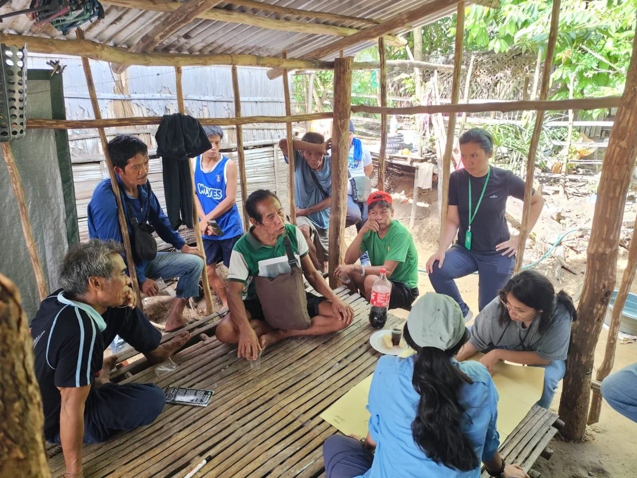
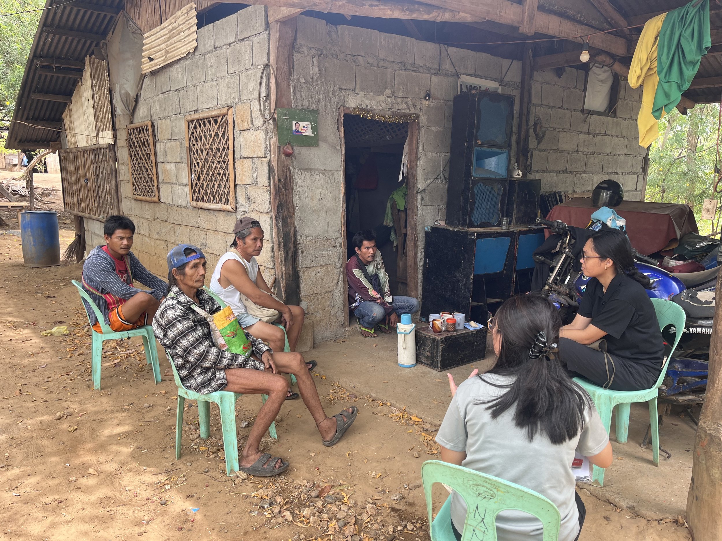
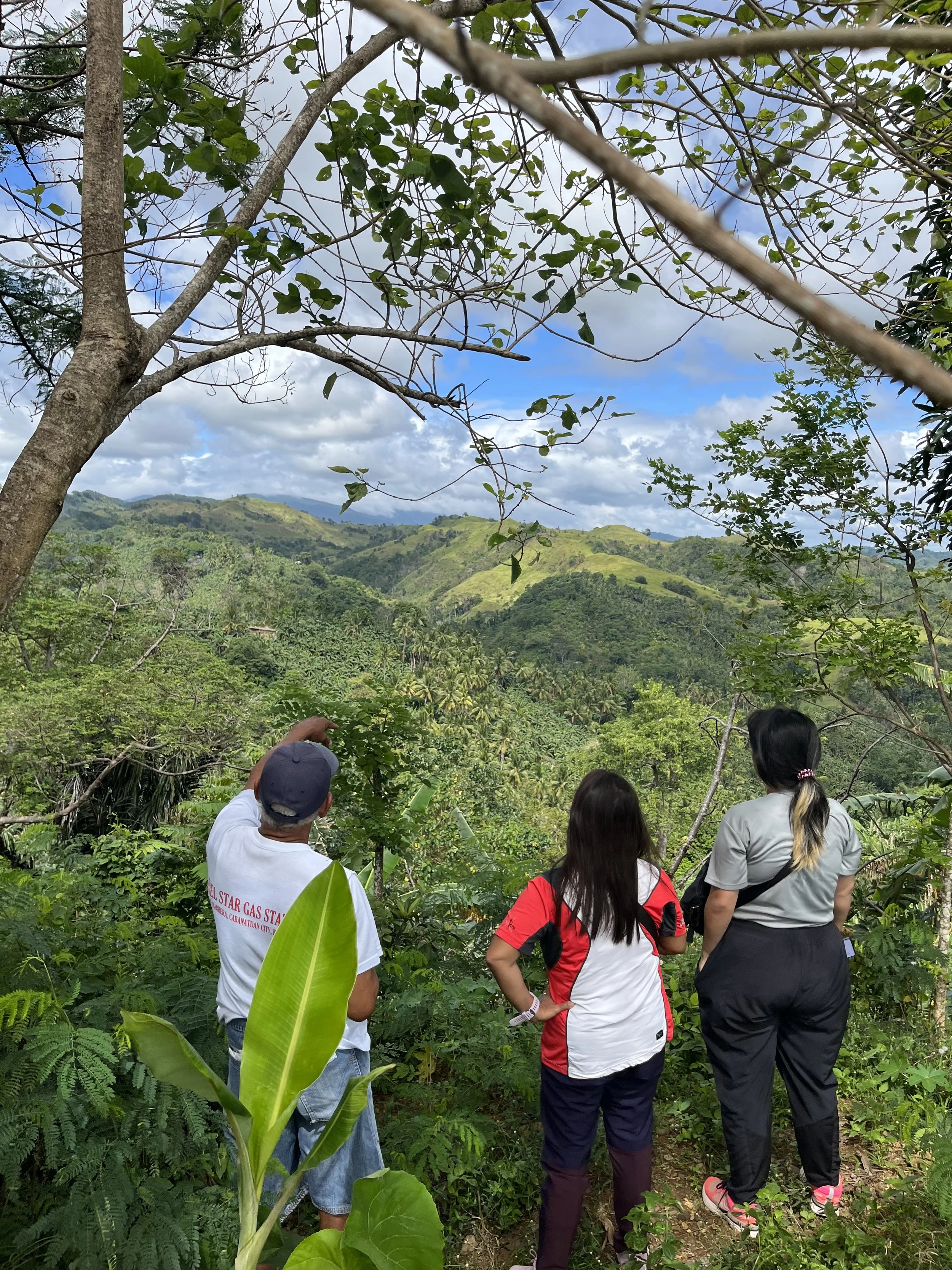
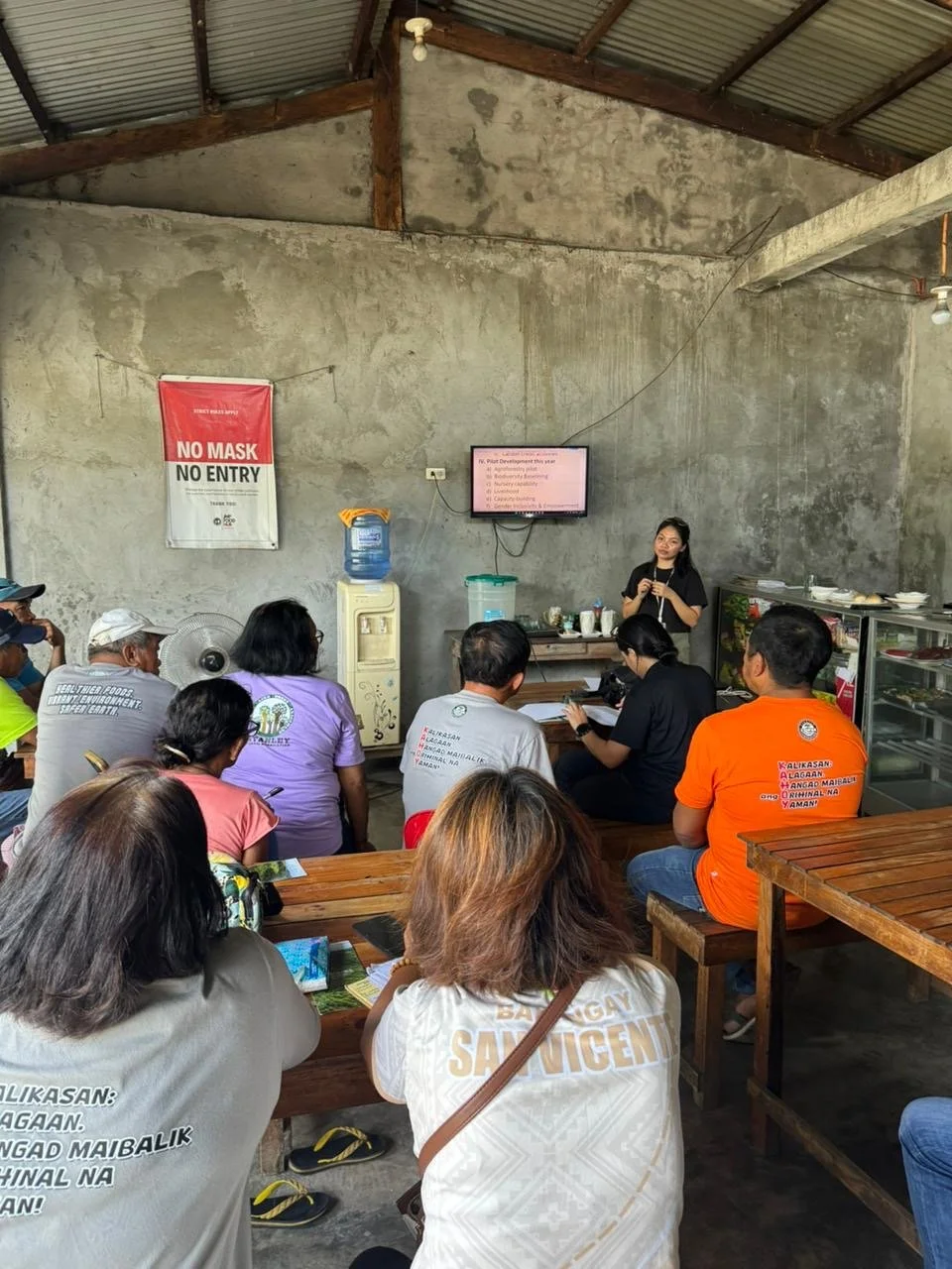
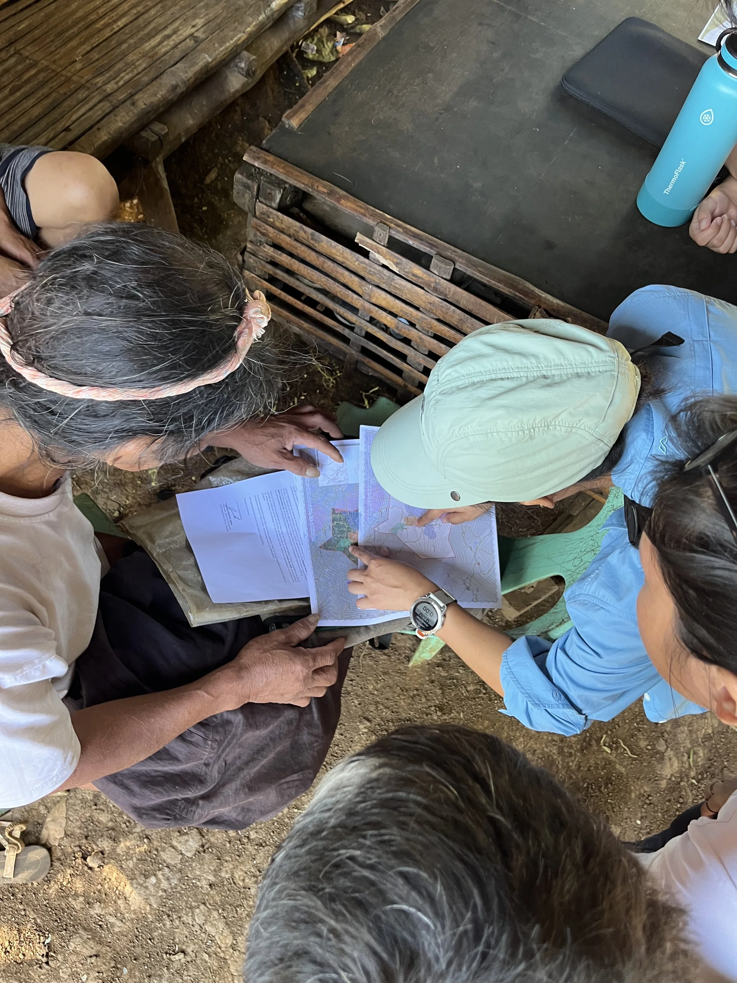
Wovoka's starting point is participatory mapping. Before any planting begins, communities decide which areas to restore. This is not a consultation layer added on top of a pre-decided plan. Communities identify sacred grounds that cannot be touched, degraded areas suitable for restoration, and plots where agroforestry can generate income alongside native tree planting. That process shapes the spatial design of the project from the beginning.
Wovoka keeps the community-facing side of monitoring in-house. Field monitoring uses smartphones equipped with low-bandwidth apps that allow communities to geotag trees, photograph plots, and flag illegal activity in near real-time. Camera traps and audio monitoring devices support biodiversity data collection. Because the project's core thesis relies on human and ecological well-being, Wovoka is concurrently pursuing the Climate, Community & Biodiversity (CCB) standard alongside its core carbon verification. The FPIC process, the multi-strata agroforestry design, and the deployment of sensors to monitor endemic wildlife lay the foundation for CCB certification, ensuring the project delivers measurable, third-party verified socio-economic and ecological benefits.
For the carbon accounting layer, the project is being developed under Verra's VM0047 methodology, the current standard for afforestation and reforestation, which requires dynamic performance baselines rather than static historical models. To meet that requirement, Wovoka works with Kanop, a nature tech company that uses AI and synthetic aperture radar data to model forest carbon stocks and monitor control plots outside the project boundary. Kanop's models build directly on field-validated data collected by Wovoka's ground teams, providing the independent verification that VM0047 mandates. The division of responsibility is deliberate: community-facing data collection stays in-house where local relationships and trust matter most; the crediting-level carbon modeling goes to a specialist whose methods can withstand third-party audit.
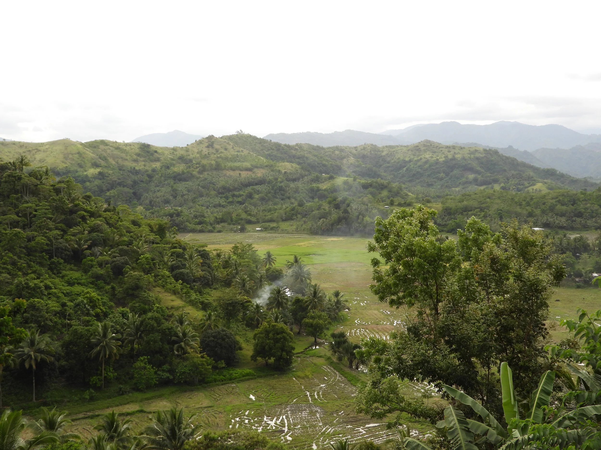
Image Credits: Wovoka
What This Enables and Where It Falls Short
The community co-ownership model addresses the permanence problem in a way that monitoring technology alone cannot. Satellite imagery can detect deforestation after it happens. A community that earns from a living forest has reason to prevent it from happening at all. By building economic incentives directly into the project structure, Wovoka is trying to make the forest self-defending over a 40-year horizon, rather than dependent on external enforcement that may not be there in year ten or year twenty.
The multi-strata planting design means communities do not have to wait decades for the forest to generate income. Agroforestry crops produce yields within a few years of planting, providing a near-term income stream that sustains community engagement during the long establishment period of the native tree canopy.
The hybrid MRV approach is a practical response to a real constraint. Building and maintaining satellite-based carbon modeling infrastructure in-house would be prohibitively expensive for a project at this stage. Keeping community-facing data collection in-house, where local relationships, language, and trust matter most, while outsourcing the technical carbon modeling to a specialist reflects a considered division of responsibility.
The limits are significant and should not be minimised.
The project is at pilot scale. Twenty hectares planted across a potential restoration area of hundreds of thousands of hectares is the very beginning. Expanding to an island-wide program involves multiple ancestral domains, multiple rounds of the FPIC process, and a level of community training and coordination that Wovoka describes as a major educational mission. That scaling challenge is not primarily a technology problem. It is a people, time, and capital problem.
The legal landscape for forest carbon in the Philippines is still evolving. Wovoka is navigating bureaucratic processes to secure formal agreements with government bodies, and delays in those processes add cost and uncertainty to a project that is already severely capital-constrained.
Total secured funding is approximately $1 million, against a project that will require tens of millions over its full lifespan.
The dynamic baselining work with Kanop remains in progress, with ground-validated field data still to be delivered. The carbon accounting foundation of the project, which underpins its entire ability to generate and sell credits has not yet been fully established. That is the single most material near-term risk for the project's financial viability.
What Others Can Take From This
Make the community the permanence mechanism, not the monitoring technology. Geotagging apps and camera traps can document what is happening in a forest. They cannot replace the incentive structure that determines whether communities protect or clear it. Wovoka's design puts economic co-ownership at the center because that is what actually changes behavior over a 40-year horizon.
Agroforestry is both an ecological and a financial tool. Multi-strata planting that integrates high-value crops with native tree restoration generates near-term income that sustains community engagement through the long establishment period. It also puts people on the land regularly, which is the lowest-cost form of encroachment monitoring available.
Integrate citizen science with advanced nature tech for MRV. You cannot accurately monitor a forest just by satellite images; securing reliable data requires boots on the ground. However, raw field observations must then be translated into a certified financial asset. Pairing community-driven data collection with specialized, credible technical infrastructure bridges this gap.
The FPIC process is a project design constraint, not a compliance checkbox. Getting it right is slow. Getting it wrong does not just create an ethical problem, it destroys the community relationships the permanence model depends on. Projects that treat land tenure as an administrative step rather than a foundation will encounter permanence failures that no amount of monitoring technology can fix.
This is one approach, not a template. Wovoka's model is shaped by a specific combination of factors: a founder who grew up on the island with existing community relationships, a landscape with both public forest land and indigenous ancestral domains requiring different legal pathways, and a carbon market that provides a financing mechanism suited to long-horizon projects. Not all of those conditions will be present elsewhere. The transferable principles are in the ownership model and the incentive structure, not in the specific instruments used to implement them.
Case Classification:
Material Change · Monetization · Measurement and Monitoring · Reforestation · Agroforestry · Carbon Credits · Community Co-ownership · Indigenous Land Tenure · Tropical Forest · Hybrid MRV · Nature-based Carbon Sequestration